Risk Assessment

Use satellite imagery to estimate inundation depths
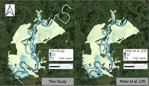
Satellite imagery is processed using Google Earth Engine (GEE) to identify flood extent. The team’s SPM-GEE model then estimates flood depths within the identified areas.

Satellite imagery is processed using Google Earth Engine (GEE) to identify flood extent. The team’s SPM-GEE model then estimates flood depths within the identified areas.