Skip to content
感測器
快拆式淹水感測器之開發與應用
模式開發
HIM模型可快速提供都市淹水預報結果
FloodDiff影像合成淹水模型
災害風險評估
氣候變遷情境下之臺灣颱風降雨預測:兩階段貝氏回歸模型之應用
研究成果頁
期刊
研討會
聯絡我們
Menu
感測器
快拆式淹水感測器之開發與應用
模式開發
HIM模型可快速提供都市淹水預報結果
FloodDiff影像合成淹水模型
災害風險評估
氣候變遷情境下之臺灣颱風降雨預測:兩階段貝氏回歸模型之應用
研究成果頁
期刊
研討會
聯絡我們
Facebook
X-twitter
Instagram
感測器
快拆式淹水感測器之開發與應用
模式開發
HIM模型可快速提供都市淹水預報結果
FloodDiff影像合成淹水模型
災害風險評估
氣候變遷情境下之臺灣颱風降雨預測:兩階段貝氏回歸模型之應用
研究成果頁
期刊
研討會
聯絡我們
Menu
感測器
快拆式淹水感測器之開發與應用
模式開發
HIM模型可快速提供都市淹水預報結果
FloodDiff影像合成淹水模型
災害風險評估
氣候變遷情境下之臺灣颱風降雨預測:兩階段貝氏回歸模型之應用
研究成果頁
期刊
研討會
聯絡我們
Search
Search
Close this search box.
期刊
1 4 月, 2026
文章發表於 Taiwan Water Conservancy, accepted. (EI)
Combining satellite imagery and digital elevation models to create flood depth maps for urban areas.
Chen, L. F., &
Yang, T. H.
* (2026, April).
其他研究
論文發表
Development of an edge computing-based sensory network to mitigate the impact of natural disasters in pond aquaculture
2 8 月, 2024
・
2023 GSsympo
氣候變遷情境下之臺灣颱風降雨預測:兩階段貝氏回歸模型之應用
26 4 月, 2026
・
第27屆全國水利工程研討會, 114年9月30日,新竹,台灣。
A Novel Multimodal Large Language Model-Based Approach for Urban Flood Detection Using Open-Access Closed Circuit Television in Bandung, Indonesia
8 11 月, 2025
・
Water, 17(18), 2739. (N/M=40/128=31.25%, WATER RESOURCES, 2023)
Using Physically Estimated Temperature as Inputs to Enhance the erformance of the LSTM Model for Predicting Water Temperature in Fishponds
8 11 月, 2025
・
Smart Agricultural Technology
Combination of Large Language Models and Portable Flood Sensors for Community Flood Response: A Preliminary Study
1 4 月, 2025
・
Water 2025, 17(7), 1055. (N/M=40/128=31.25%, WATER RESOURCES, 2023)
研究項目
模式開發
感測器
災害風險評估
模式開發
感測器
災害風險評估
分享文章
Prev
上一篇
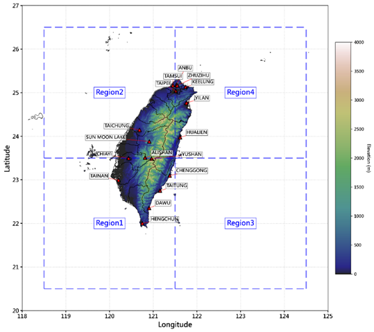
A Statistically Integrated Approach for Assessing Typhoon-Induced Rainfall in Taiwan under Climate Change Scenarios.
下一篇
Three Pathways for Physics Integration in Neural Network: A Case Study on Fishpond Temperature Prediction.
Next